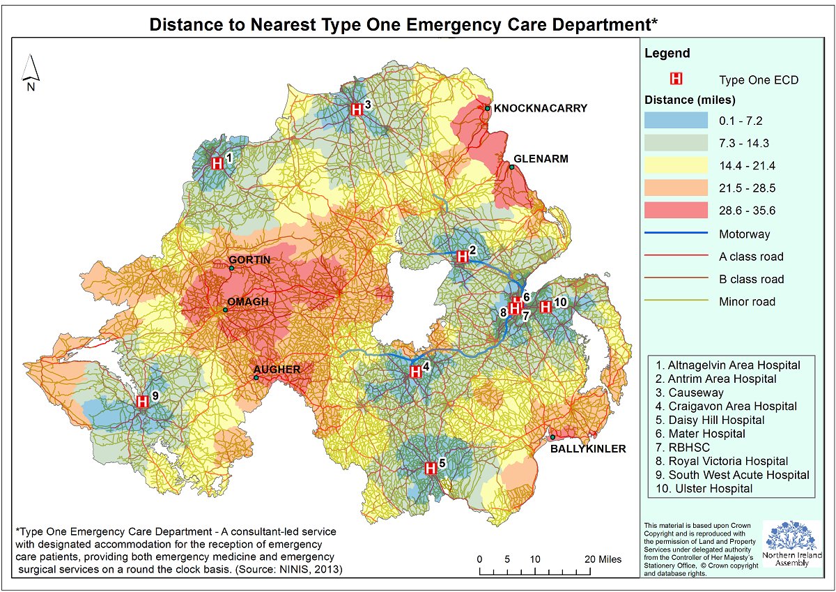
Figure 1: Map presenting time travel analysis in relation to the nearest type one emergency care department
Everything happens somewhere. How does the Northern Ireland Assembly’s in-house geographic information service help Members analyse and visualise complex data?
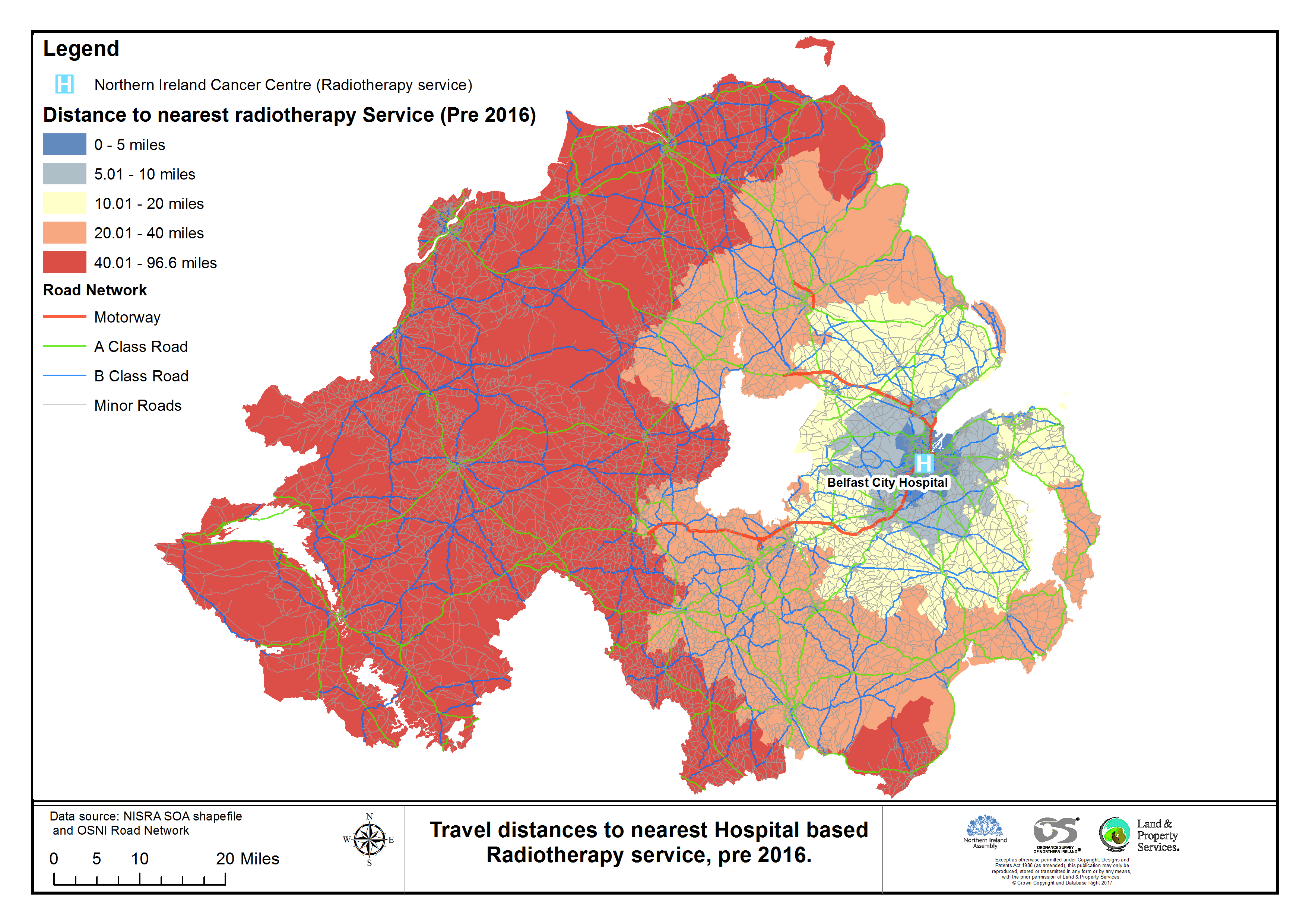
Over 80% of data used by our public sector services – environment, health, education, security, construction, transport, agriculture, heritage, sport and employment – has a geographic element e.g. an address or a coordinate. All these can be mapped. The advantage of mapping information rather than producing a table of information is that it allows users to easily review, analyse, visualise and understand previously unseen patterns, gaps, issues or problems. Analysing data in this way can lead to improved decision making. Examples of the kinds of geographical analysis produced by the Research and Information Service can be seen in figures 1 and 2.