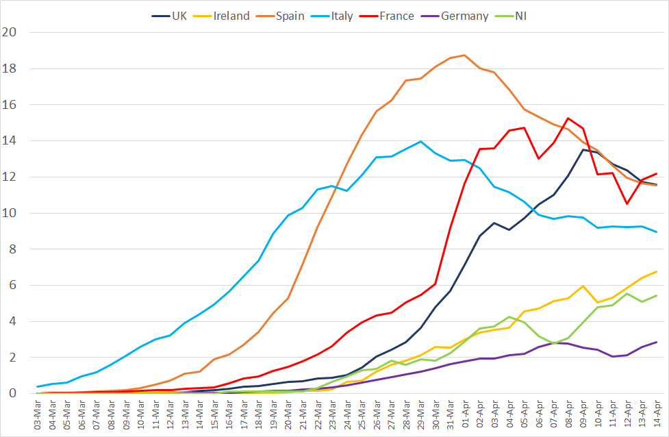
By Keara McKay & Thomas Procter This is a visualisation prepared and maintained by the Northern Ireland Assembly Research and Information Service (RaISe). It presents… Read More »Visualisation of COVID-19 in Northern Ireland
Our blog has just published its 100th article. The Assembly Research and Information Service launched Research Matters in May 2016 in order to provide short,… Read More »Research Matters at 100
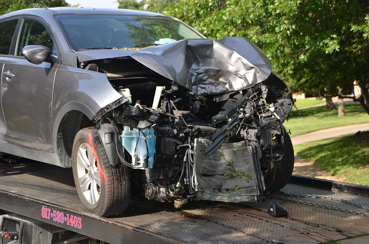
It is difficult to grasp the full extent of what is portrayed by road traffic collision statistics. Each statistic represents a human being and, in the case of those killed or seriously injured, is an untold story of heartbreak and despair, wreaking devastating havoc on families across Northern Ireland. Identifying the factors that contribute to these collisions can inform public education, new technologies and enforcement with the aim of reducing the number and impact of road traffic collisions.
A car involved in a road traffic collision being towed (Image: Pixabay)
Please note that the Constituency Profiles have been updated with a new layout and are available on a new page here.
The Research and Information Service (RaISe) has just produced updated 2016 Constituency Profiles for each of the 18 constituencies in Northern Ireland. This article looks at why and how these profiles are produced.
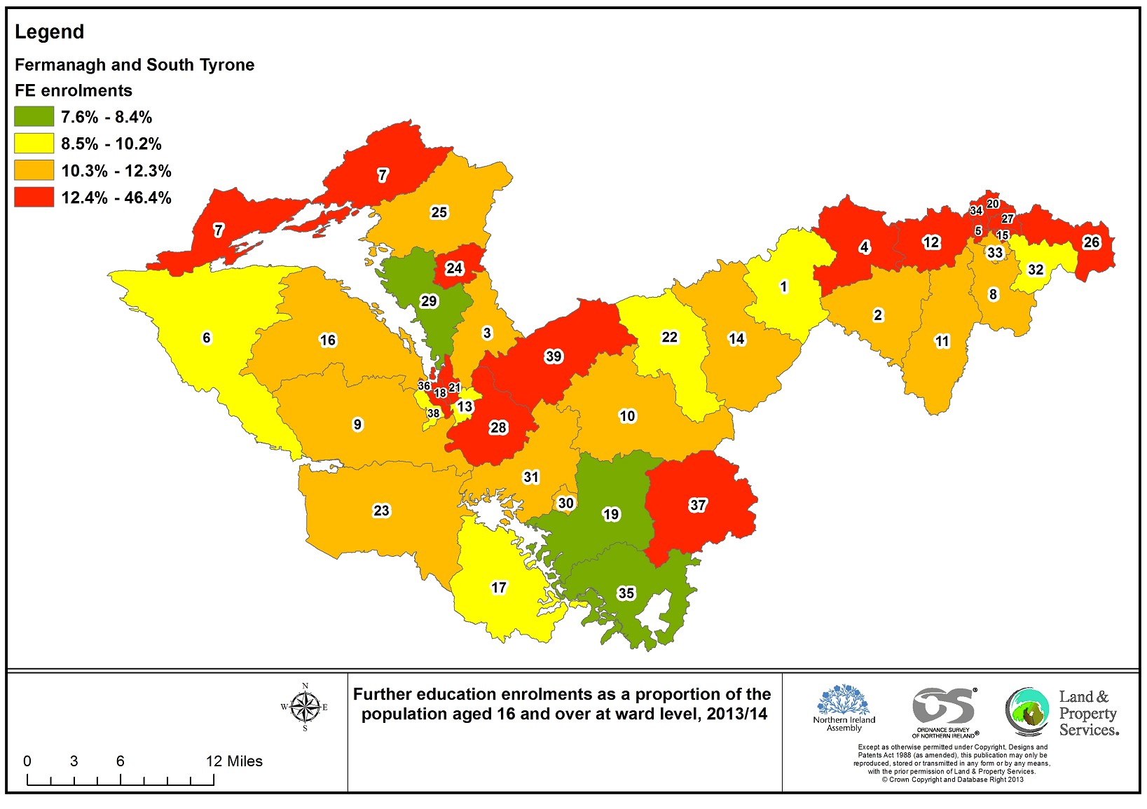
Map of Fermanagh and South Tyrone highlighting further education enrolments as a proportion of the 16+ population for 2013/14

")